Space technology for Rwanda: Prevention and Mitigation of natural disasters

The science of earth observation (EO) is gaining ground in Africa/ PHOTO Credit: LIVE ECO
More than four decades, the National Aeronautics and Space Administration’s (NASA) Landsat and the European Space Agency (ESA) Sentinel Satellites, 2014, have captured images of Earth and help us to understand this big rock which we all call home (Planet Earth) as well as ourselves.
Seeing things from a distance can help us, Nowadays, to get satellite imagery is just a click and get but this requires to register from a service provider either from USA (https://earthexplorer.usgs.gov/) or European Space Agency (https://scihub.copernicus.eu/dhus/#/home) and also there is an elephant in the room which is a Google Earth Engine this has combined all service and with help of new technology such as Artificial intelligence, Machine Learning, and others you can do everything from pre-processing, data visualization to interpretation.
Natural disasters are extreme events within the earth’s system that result in death or injury to humans, and damage or loss of valuable properties, such as buildings, communication systems, agricultural land, forest, natural environment, etc.
The economic losses due to natural disasters have shown an increase with a factor of eight over the past four decades, caused by the increased vulnerability of the global society, but also due to an increase in the number of weather-related disasters.
Space technology is the ideal tool for disaster management since it offers information over large areas and at short time intervals. Although it can be utilized in the various phases of disaster management, such as prevention, preparedness, relief, and reconstruction, in practice up till now it is mostly used for warning and monitoring.

During the last decades’ space technology has become an operational tool in the disaster preparedness and warning phases for flood, and droughts. The use of remote sensing is not possible without a proper tool to handle large amounts of data and combine it with data coming from other sources, such as maps or measurement stations.
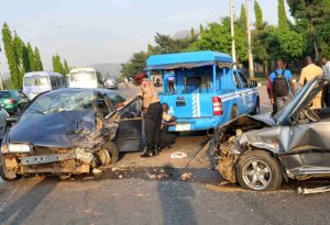
Rwanda is prone to droughts, earthquakes, floods, landslides, storms, and volcanoes. The effects of flood hazards have worsened as recent population growth and land scarcity have pushed people to settle in flood-prone areas. The recent heavy rain has shown us that we are not immune to the natural disaster in northern and western provinces led to flooding that caused extensive damage and impacted about 11,000 people.
Since 1970, the country has experienced a higher than global average temperature increases and Rwanda is already experiencing the impacts of climate change. Climate change is bringing more irregular and unpredictable rainfall patterns with shorter rain seasons to the largely rain-fed agriculture sector.
It is impossible to define the entire natural disasters (flood, droughts, landslides) potential in a given area. However, given the best space technology data for the situation and a competent interpreter, the evidence for potential flood situations can be found or inferred. The most obvious evidence of a major flood potential, outside of historical evidence, is the identification of floodplain or flood-prone areas that are generally recognizable on Satellite imagery.
The most valuable application of space technology to flood hazard assessments, then, is in the mapping of areas susceptible to flooding. Space technology data can be used very effectively for quickly assessing the severity and impact of damage due to, earthquakes, landslides, flooding, cyclones, and other disasters.
During the disaster prevention stage, space technology is used in managing the huge levels of data required for vulnerability and hazard assessment. In the disaster preparedness stage, space technology is a tool for planning evacuation routes, designing centers for emergency operations, and for the integration of satellite data with other relevant data in the design of disaster warning systems.
In the disaster relief phase, space technology, in combination with Global Positioning System (GPS), is extremely useful in search and rescue operations in areas that have been devastated and where it is difficult to find one’s bearings.
In the disaster rehabilitation stage, space technology is used to organize the damage information and post-disaster census information and in the evaluation of sites for reconstruction. Natural hazard information should be included routinely in developmental planning and investment project preparation.
To implement measures to mitigate the impact of disasters, it is important to measure and predict the impact of future natural disasters. At all stages of crisis management, satellite information as meteorological information, an independent and objective source of information plays an essential role.
Authors:
- Dr. Yves Hategekimana is a researcher at Aerospace Information Research Institute, Chinese Academy of Sciences
- Fabrice Gatete is a CEO at BDS Ltd Rwanda and Technology enthusiast

About The Author

SUBSCRIBE TO OUR NEWSLETTER